Most visitors see the Zona Colonial from the inside, as a grid of stone streets, and forget that the whole district was laid out to face water. The Río Ozama runs along its eastern edge, and the Caribbean closes it on the south. A river mouth with a harbor is why the city is here, and much of the old city, from the fort at the river mouth to the gates in the walls, was arranged around it.
This article follows the river and the harbor from the founding of the city to the cruise terminals you can see today. It covers where the city first stood, why Governor Ovando moved it, what the waterfront looked like in the colonial period, how people crossed the river before there were bridges, and what the port is now. It also covers the state of the river itself, which is a real subject in the capital and deserves a plain account. Several of the buildings along the waterfront have their own pages, and they are linked as they come up.
The River Itself
The Ozama is not a large river by world standards, but it matters in the Dominican Republic. A Dominican newspaper report says it rises at Loma Siete Cabezas in the Sierra de Yamasá and runs about 148 kilometers to the Caribbean, dividing the city of Santo Domingo in two. Its named tributaries include the Yamasá, Guanuma, La Savita, Yabacao, La Isabela and El Cachón de la Rubia. The same article cites an executive summary which says the basins of the Ozama and Haina rivers hold most of the country's population and economy, along with the national port system, and supply about 60 percent of the drinking water for the capital's metropolitan area. The article is from 2014, so treat the figures as that year's.
For the colony the river was a harbor. For the people who live along it now it is also a boundary. The Zona Colonial is on the west bank. Santo Domingo Este is on the east. Where you stand determines what you see: the old city's walls and gates on one side, the container cranes and cruise berths near its mouth, and farther upstream the wetlands.
The First Settlement, 1496
Diario Libre says the first stone of Santo Domingo was laid on 4 August 1496 on the left bank of the Ozama's mouth. That is the east bank. An article in Acento on the city's origins says the town was laid out in 1496 on the river's eastern side and that, after hurricanes and relocations, it was not yet permanently settled. The Zona Colonial, the grid you walk today, was not the first Santo Domingo. It was the second.
You will see two founding years in print. Diario Libre and Acento, two Dominican sources, both give 1496. Many guides, including other pages on this site, give 1498. This page uses 1496 for the first settlement here, and the arc from the first settlement to the move is told in A History of the Zona Colonial.
Why the city moved is only partly documented. Diario Libre says Governor Nicolás de Ovando's fleet arrived on 15 April 1502 with about thirty ships and roughly 2,500 people, and that a hurricane devastated the city in early July of that year. Ovando then moved it to the right bank of the Ozama, the west bank, and later to the site where the old city stands. A reference biography of Ovando says only that Santo Domingo was refounded on the opposite bank, laid out on a gridiron plan. Diario Libre links the move to the hurricane. The other sources do not give a reason, so none should be claimed for certain.
What the west bank offered is plainer. El Día, in an article about the Fuente de Colón, says the settlement was moved to the bank of the river where a spring stood, and compares the street plan to Santa Fe, the military camp built during the siege of Granada. Whether the spring was the reason or a convenience, a freshwater source beside a harbor is what a port needs. The article is careful to call that part probable, not proven.
The Colonial Waterfront
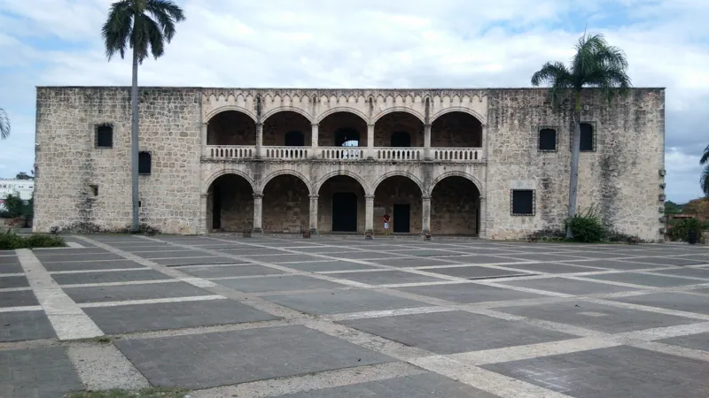
The Acento article describes the west bank as a single system. It says the audiencia, the town council and the port sat together, with the Alcázar de Colón and the Casas Reales forming a government axis that faced the port and the sea. The Torre del Homenaje and the Fortaleza Ozama controlled the mouth of the river and also served as a prison and a symbol of power. For the fort, see Fortaleza Ozama. For the palace, see Alcázar de Colón, and for the building that held the court, see Museo de las Casas Reales.
The research book The Italian Legacy in the Dominican Republic describes how the walls met the water. The city's walls faced the interior of the island to the northwest, the river to the east and the sea to the south, where a natural rocky wall was used where it existed. The Ozama Fortress guards the southeast entry and is separated from the river by a stone wall. A concrete fortification was added around it in the 1950s. The Bulwark of the Invincible stands where the river narrows and is described as one of the most important parts of the whole perimeter. The same chapter says boats arriving at the port were greeted from the Torre del Homenaje, which rises 18 meters.
The Gates to the River
The walls had gates, and several opened toward the water. Diario Libre says the walls were begun in the first decades of the 1500s and took about two centuries to finish, with long pauses. Gates were closed at nightfall to protect the residents. Two gates matter for the river.
The Puerta de la Atarazana, according to the same article, was used to bring in ships for repair and caulking at the nearby Atarazana, the royal shipyard and warehouse. The Atarazana is the subject of Plaza de España and La Atarazana.
The Puerta de San Diego was built in the 16th century by the master builder Rodrigo de Liendo, says Diario Libre, and takes its name from the nearby viceregal palace of Diego Colón. The article says the gate's central axis is angled away from the palace, so that it could protect the palace from an outside attack. Its exterior carries noble family coats of arms carved in stone and reflects the plateresque style of 16th-century military architecture. El Día adds that it has restored heraldic shields, including one of Charles V. Published guides date the gate to different years, so none is given here. It stands on Avenida del Puerto, the avenue along the river.
The Fuente de Colón and the Ceiba
The riverfront has a legend of its own, and El Día places it on Avenida del Puerto. According to the article, a tradition holds that Christopher Columbus tied his ship to a centuries-old ceiba tree, a kind of tropical tree, along the river. The remains of the original tree are encased in concrete, and a living ceiba beside it is described as a branch of the legendary tree. The article calls the story a tradition wrapped in legend.
Next to it is the Fuente de Colón, a structure that the article describes as built of limestone blocks in the Spanish Plateresque style, with steps, a basin, columns, pilasters and a brick vaulted roof. Water from it was stored in jars for ships. The authors say they do not know its exact construction date or who ordered it built, and that it was probably built during the governorship of Ovando. They also say the fountain was originally a freshwater spring that flowed into the Ozama and that it supplied ships on the expeditions, but they present that as their own interpretation without a cited source. Both the legend and the doubt are given. The tree and the fountain are a pleasant place to stand and look at the river. The claims attached to them are best treated as local tradition.
A Port That Lost Importance
Expeditions to other parts of the Americas departed from the fort at the river mouth. But the port's importance did not last. The research chapter on Antonelli's walls says that by the time the engineer arrived in 1589, the city had already lost some of its political and commercial importance to new ports on the Pacific side of the Americas.
The raid of 1586 gave a sharp example of what the harbor held. Diario Libre says that Francis Drake's forces carried off goods stored at the port and in other warehouses, along with the ships that had not been burned. The Bigges account of the expedition lists what the English found in the city: sugar, ginger, hides, wine, oil, vinegar, wheat meal, cloth, earthenware and glass. Those are the goods of a trading port. The whole story is in Francis Drake's Raid on Santo Domingo in 1586. After the raid, Acento says the walls were widened, bastions were armed, and patrols and curfews were regulated. The century that followed is in Santo Domingo in the 1700s.
The Trujillo era changed the waterfront again. The Muralla de Félix Benito was built when the port and the Malecón were created, and that material dredged from the port was used to make land for the highway. Part of today's waterfront was therefore made in the 20th century.
Crossing the River
For a long time there was no bridge. A Dominican property publication says people crossed between Borojol on the west bank, near the colonial walls, and Pajarito on the east bank, by small boat or canoe. Pajarito was renamed Villa Duarte on 28 May 1890. The same article says that on 30 July 1843 Juan Pablo Duarte crossed the river by boat to the house of Pascual C. López, fleeing the Haitian government's persecution, and left for Vieques, Puerto Rico, on 2 August. His life is told in Juan Pablo Duarte.
The first bridge opened on 28 April 1878. It was an iron and wood frame built by the engineer Howard Crosby, and crossing it required a toll paid to Crosby. A flood swept it away in 1883, leaving about half the structure. During the American military occupation of 1914 to 1917, foundations were laid for a new platform named after President Ulises Heureaux. The central spans were a drawbridge that rose to let ships through, which could stop traffic for up to an hour. The San Zenón cyclone of 1930 damaged the bridge badly, and about 1933 the Trujillo government rebuilt it with national funds. In 1976 President Joaquín Balaguer opened the Ramón Matías Mella Bridge at Crosby's original site. Locals called it the bicycle bridge for its narrow roadway. A twin bridge beside it, begun in the early 1990s, gave the crossing four lanes and opened in 1996. The article adds that part of the structure collapsed on 16 February 1990 during construction, killing three Dominican workers and a Colombian technician.
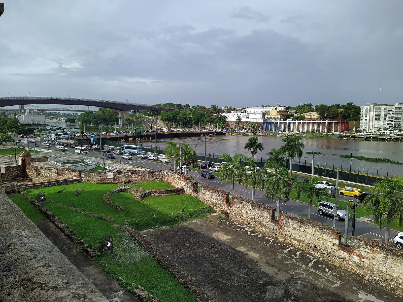
The photograph at the top of this page shows the Floating Bridge and the Mella Bridge, with the Juan Pablo Duarte Bridge farther upriver, according to the photo caption.
The Modern Port
The port today is run by Sansoucí, which says it has managed it under concession since 2005. The operator describes the port as the main multipurpose port in the country and as "the first in America," which is the operator's own claim. It says Sansoucí is the only port in the city of Santo Domingo that handles passenger operations. It reports 1,854 meters of berthing line across 10 piers, a 320 meter turning circle for ships, and services to Puerto Rico and Florida. Through Ferries del Caribe, it says, the port offers passenger service between Santo Domingo and San Juan.
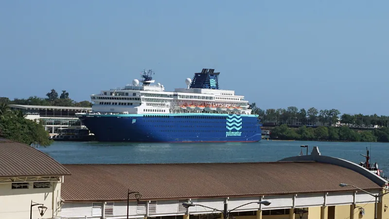
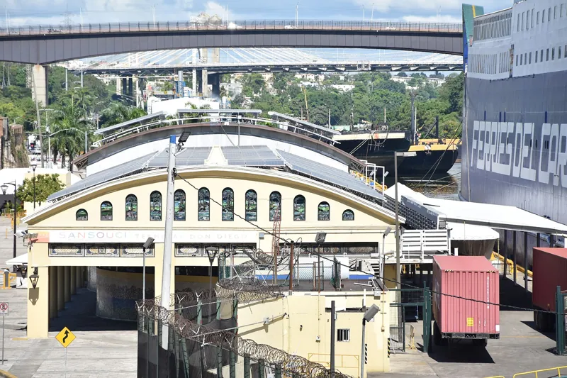
The cruise side is the part visitors see. The operator describes two terminals. The Don Diego Terminal is designed for up to 3,000 passengers, and the Sans Souci Terminal for up to 5,000. It describes the port as a short walk from the Colonial City and about 20 minutes from the Las Américas International Airport. The Don Diego Terminal sits on Avenida del Puerto, in the Ciudad Colonial itself.
The money behind the rebuild is on record. The International Finance Corporation's disclosure for Sans Soucí Ports lists a 40-year build-operate-transfer concession to expand and operate the Sans Soucí and Don Diego cruise terminals. It describes goals to rehabilitate the terminals, to address pollution affecting the Ozama River basin, and to upgrade the navigational channel and turning basin. The disclosure gives a total project cost of 38.2 million dollars and says the IFC board approved 21 million dollars in loans on 16 November 2006, and the deal was signed on 22 November 2006. A Lloyd's List item dated 20 August 2007 says the new Sans Souci cruise terminal was due to enter service at the end of that year, with Royal Caribbean's Legend of the Seas, which carries 1,800 passengers, based there for the winter season. The exact opening date is not given in these sources, so it is left out.
For a visitor the effect is that cruise ships tie up beside the old city. Photographs of the Don Diego and Sans Souci terminals were taken from the Alcázar and the Ciudad Colonial.
The River Today
The Ozama has a pollution problem. The same report describes advanced degradation. The river receives large amounts of waste of different kinds, and the article blames a history of official neglect and daily mistreatment by residents and industry. It says more than 20 projects to recover the river have failed. It also describes a protected area, the Parque Nacional Humedales del Ozama, about 47 square kilometers of wetlands and mangroves on the river's banks. It was declared a national park in 2002, joined the national protected areas system in 2004, and recovery began in 2009. The fauna it lists includes royal herons, kingfishers and coots. The article, again, is from 2014.
A more recent effort is easy to find. The Ocean Cleanup installed a river interceptor called Interceptor 004 near the mouth of the Ozama. Its report says the machine was launched on 15 August 2020, that Tropical Storm Laura hit five days later and brought a flood of water hyacinths that damaged its mooring, and that it was repositioned in early January 2021 and began removing debris within a week. The Dominican Navy runs it with the United Nations Development Programme, and its collection uses six dumpsters emptied at a dedicated quay. Local fishermen, the report says, have found plastic, including intact bags, in fish stomachs.
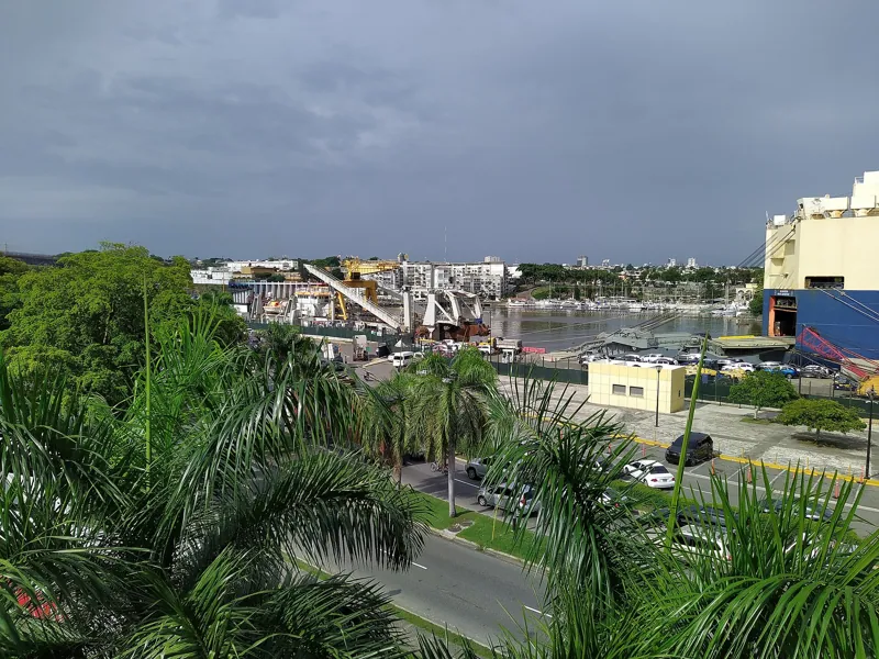
The pollution is worth a mention for a plain reason. Anyone who expects a postcard river will be surprised by it. The Ozama is a working river in a large capital, and the views from the old city are better for the architecture than for the water. Looking at it from the Alcázar, though, you can see what the photographs show: the Don Diego terminal in the foreground, the Marina Bartolomé Colón and the Molinos del Ozama beyond it, and bridges upriver.
Walking the Waterfront
The simplest riverfront walk follows Avenida del Puerto between the Puerta de San Diego and the Fortaleza Ozama, which are about 540 meters apart in a straight line. Look at the coats of arms on the gate, then walk toward the fort, where the Torre del Homenaje stands at the river's mouth. El Día puts the ceiba and the Fuente de Colón on the same avenue. If you want a longer route, the Santo Domingo landmarks guide and the Zona Colonial guide place the waterfront inside the larger walk, and A History of the Zona Colonial gives the arc of the whole district.
The cruise terminals are working port areas, and no source on public access to them is cited, so ask before you try to walk in. The photographs of the river were taken from the Alcázar, and the Italian-Dominican research book says boats arriving at the port were greeted from the fort's tower. Hours at both change, so check before you go.
Getting there from the penthouse
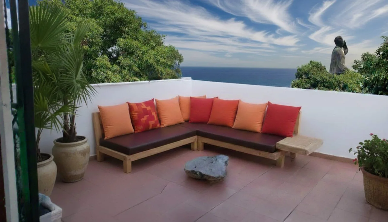
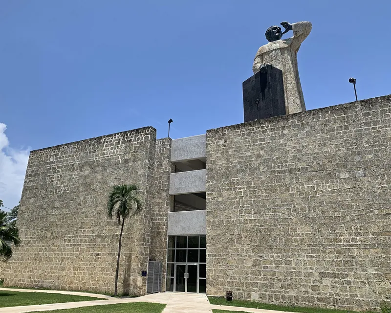
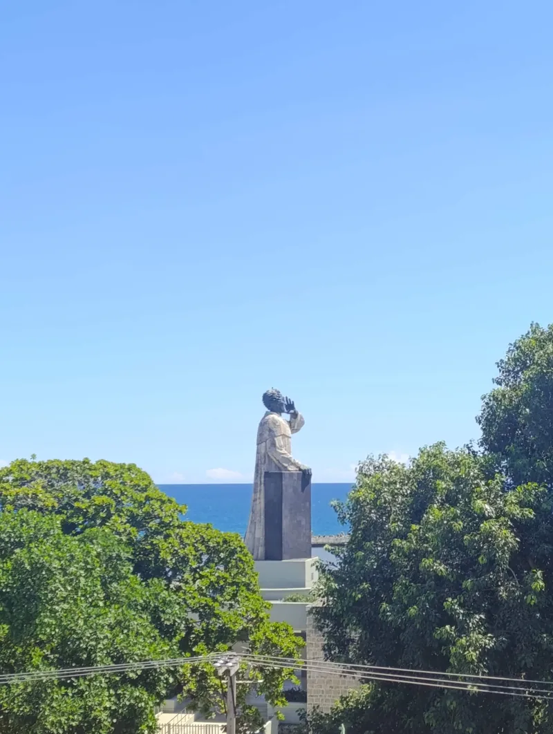
Penthouse Pallazzo is on the sea edge of the Zona Colonial, facing the Montesinos monument, so the Caribbean is the near water and the Ozama is the far one. The straight-line distance to the Puerta de San Diego, a good place to meet the river, is about 870 meters, which is about 15 minutes on foot. From there the Don Diego terminal, the riverside fountain and the fort are all within a few more minutes. The route crosses the heart of the old city, so give yourself time to stop. A ride is unnecessary.
Frequently asked questions
Why is Santo Domingo on the Ozama?
The city began on the river's east bank in 1496, and Governor Ovando moved it to the west bank after 1502. The sources do not agree on one reason for the move. What they show is a harbor and, according to El Día, a spring, at a river mouth that a fort could guard.
Where was the first Santo Domingo?
On the east bank, at the river mouth. Diario Libre says the first stone was laid on 4 August 1496. The Zona Colonial is on the opposite bank.
Is the Ceiba de Colón real?
The remains of an old ceiba tree stand by the river, and a living ceiba is beside them. The story that Columbus tied his ship to it is a tradition. El Día calls it a legend and says its authors cannot document it.
Can I see cruise ships from the old city?
Yes. The Don Diego Terminal is on Avenida del Puerto, in the Ciudad Colonial, and photo listings for Sans Souci place that terminal in Santo Domingo Este, on the opposite bank. Ship schedules change from week to week.
Is the Ozama clean?
No. A Dominican newspaper described advanced degradation in 2014, and the Ocean Cleanup placed an interceptor near the mouth in 2020 to remove plastic. Conditions change, so do not expect a swimming river.
How did people cross before the bridges?
By small boat or canoe, between Borojol on the west bank and Pajarito on the east, according to a Dominican property publication. The first bridge opened in 1878 and charged a toll.
Sources
- https://diariodigitalrd.com/2014/09/30/el-ozama-un-rio-con-vocacion-turistica.html
- https://www.diariolibre.com/portada/reportaje/la-ciudad-de-santo-domingo-y-sus-invaluables-tesoros-coloniales-BP27939181
- https://acento.com.do/opinion/cronica-de-una-colonizacion-de-los-primeros-campamentos-a-las-murallas-9575405.html
- https://encyclopedia.com/humanities/encyclopedias-almanacs-transcripts-and-maps/ovando-nicolasde-1451-1518
- https://eldia.com.do/la-ceiba-y-fuente-de-colon-una-tradicion-envuelta-en-leyenda/
- https://www.diariolibre.com/actualidad/las-puertas-de-la-ciudad-PADL1115291
- https://italianlegacyrden.academiadominicanahistoria.org.do/files/assets/basic-html/page-244.html
- https://italianlegacyrden.academiadominicanahistoria.org.do/files/assets/basic-html/page-243.html
- https://www.colonialzone-dr.com/fortaleza-ozama/
- https://inmobiliario.do/en/the-ozama-river-swept-away-the-bridge-twice-and-the-city-rebuilt-it-five-times/
- https://sansouci.com.do/
- https://disclosures.ifc.org/project-detail/SPI/24534/sans-souci-ports-s-a
- https://lloydslist.com/LL096753/Terminal-to-breathe-new-life-into-Santo-Domingo
- https://theoceancleanup.com/updates/interceptor-004-the-first-in-the-carribean/
- https://gutenberg.org/cache/epub/3334/pg3334-images.html
- https://commons.wikimedia.org/wiki/File:Rio_Ozama_desde_el_Alc%C3%A1zar_de_Col%C3%B3n_vista_norte.jpg
- https://commons.wikimedia.org/wiki/File:Rio_Ozama_desde_el_Alc%C3%A1zar_de_Col%C3%B3n_vista_sur.jpg
- https://commons.wikimedia.org/wiki/File:Terminal_Don_Diego_en_Rio_Ozama.jpg
- https://nominatim.openstreetmap.org/search?q=Puerta+de+San+Diego+Santo+Domingo&format=json&limit=3