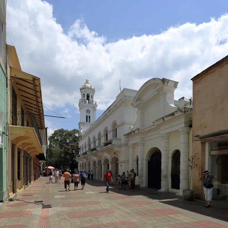
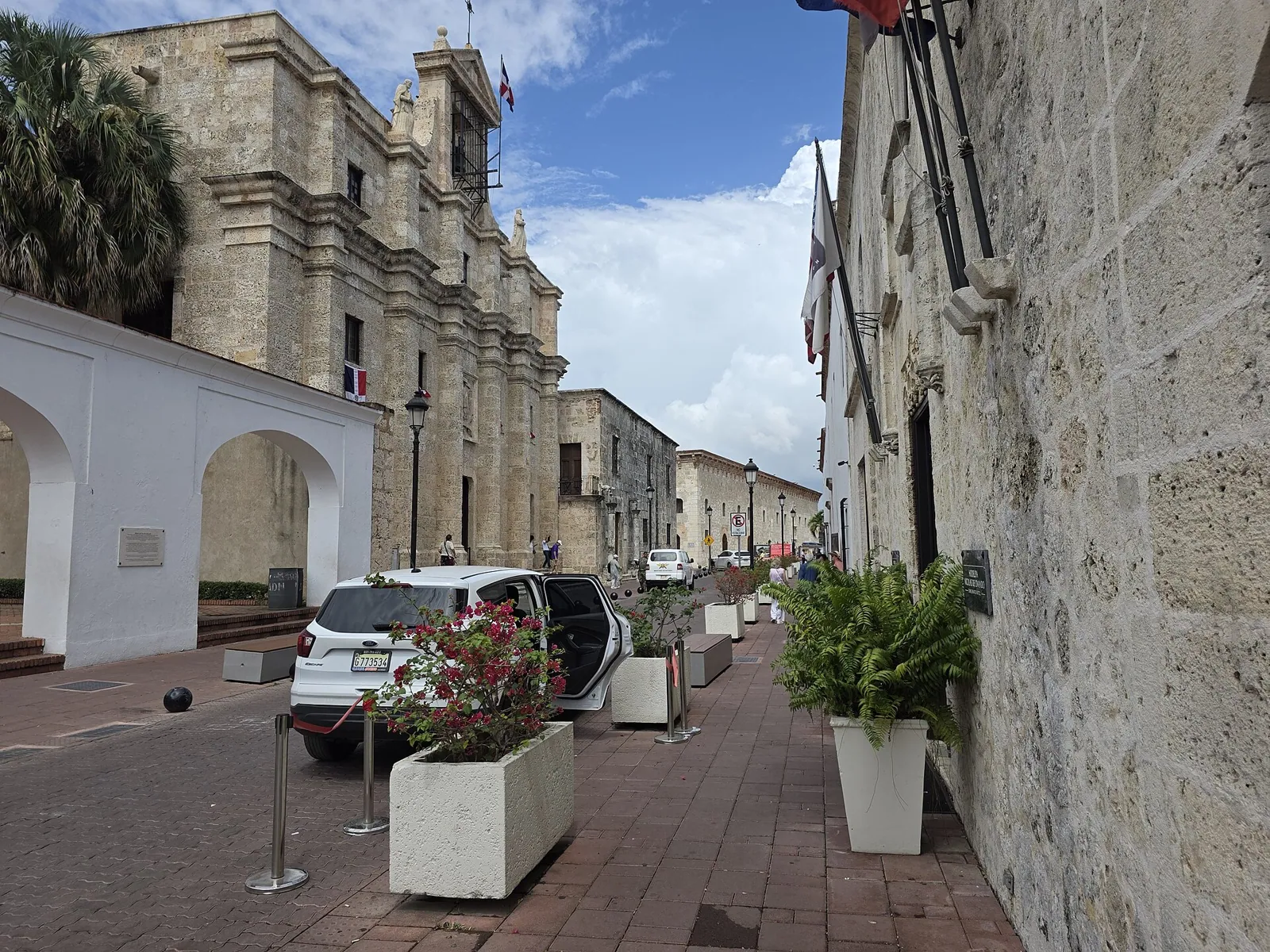
Calle Las Damas is a narrow street that runs north from the Fortaleza Ozama to the Plaza de España, one block in from the Ozama River. It is the shortest way to understand the Zona Colonial, because almost everything the Spanish built first in the Americas is either on it or a few steps away: the fort, the governors' houses, the high court, the palace of Diego Colón, the homes of early officials and conquistadors. Walked slowly, it takes about as long as a coffee. Walked properly, it takes a morning.
Tourism pages call it the first paved street in the Americas, and it is a good headline. The record is thinner than the slogan. What the sources agree on is that the street was laid out in 1502 on the order of Governor Nicolás de Ovando, and that its name comes by tradition from the ladies of the court of María de Toledo. This page separates what is documented from what is repeated, walks you down the street building by building, and says what you can go into today.
Laid Out in 1502
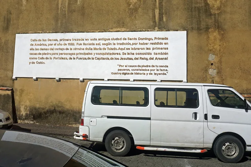
Ovando arrived in 1502 and moved the settlement to the west bank of the Ozama after a hurricane that year, according to a local guide. The street was one of the first things set out in the new town. One online encyclopedia gives the date as 1502 and says the order came from Ovando. A tourism guide agrees, and says it was laid around 1502 during his governorship. A Dominican travel article says the same. That is a lot of agreement for a single year, so the date is safe.
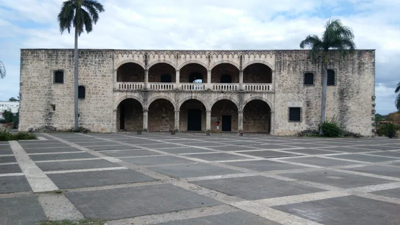
Where it ran at the start is less clear. The online encyclopedia says that in colonial times the street ran from the Fortaleza Ozama toward a point its text does not finish naming. The fortress at the river mouth dates from the early sixteenth century too, so it makes sense that the street led out from it. The Dominican Ministry of Tourism's page says the street connects directly to the Alcázar de Colón, and the page for the Alcázar de Colón tells you what stands at the north end.
The Paving Claim
Here is where to be careful. The Ministry of Tourism's own page calls Calle Las Damas the first paved street in the Americas. A Dominican travel article repeats it, and so does a local tourism guide, which also says original sixteenth-century stone paving is still underfoot. The online encyclopedia, which gives the most detail about the street's early history, calls it the first street of the New World and does not mention paving at all. The local guide says Ovando oversaw the street, then called Calle del Rey, and does not mention paving either.
The sources that give construction details say only that the street was laid out. So the fair way to put it is this: Calle Las Damas is the first street laid out in the new city, and the claim that it was also the first paved street in the Americas is widely repeated in tourism material. If you are writing about it, say "laid out in 1502" and attribute the paving claim to the tourism boards. If you are walking it, do not count on the surface underfoot being sixteenth-century stone; look at the buildings instead.
The Name
The name means the street of the ladies, and the story behind it is simple and appealing. The online encyclopedia says that the street was first called Calle de la Fortaleza, and that after María de Toledo arrived, she and her court of ladies made a habit of strolling along it, so residents began calling it Calle Las Damas. María de Toledo was the wife of Diego Colón, and she reached the island in 1509, according to El Día. The Ministry of Tourism's page says she and her ladies would walk the street in the evenings. One tourism guide says the ladies strolled it in the cool of the evening.
Every source gives this as the origin, and none cites a document from the time. It is a tradition, and a believable one, since the street ran from the governor's fortress toward the family's new palace. But a tradition is not a record. The one firm thing you can take from the timing is that the name cannot be older than 1509, because that is when the woman it points to came to the island. The street itself is older than its famous name.
The sources also disagree on what it was called before. The online encyclopedia says Calle de la Fortaleza. The local guide says Calle del Rey. A Dominican travel article lists other names the street carried over the centuries, including Calle de la Fortaleza, Calle Colón, Calle del Gobierno and Calle del Palacio, and says it finally got its name back. The pattern is what you would expect. A street in a colonial capital takes its name from whatever stands at its end: the fortress, the Columbus house, the government, the palace. That is the quiet lesson in all the names. The street has always been the road between the places that ran the colony.
The Houses at the South End
Start where the street starts, beside the fortress, and the first big house is the Casa de Bastidas.
Casa de Bastidas
Rodrigo de Bastidas came to Hispaniola on Columbus's second voyage, according to a 2016 Listín Diario article, and was born in 1460 in Triana, Seville. The article says he built the house in the early sixteenth century as his residence, though he lived there only briefly, and that he died in Cuba in 1527. His wife was Isabel Rodríguez de Romera. Their son, also Rodrigo, was born in Santo Domingo, became dean of the local church, and later bishop of Coro and then of San Juan de Puerto Rico in 1532. A nephew, called el mozo, arrived in 1508, and in 1523 killed Cristóbal Navarro and fled to Yucatán, where the article says he died three years later.
Another source calls Bastidas the founder of Coro and Santa Marta and says he was mayor of Santo Domingo in 1512. It says the building covers about 3,000 square meters around a central patio with Roman arches. Listín Diario says the patio overlooks the Ozama River and that long corridors combine several styles, including neoclassical.
The house has had an unusual second life. Listín Diario reported in 2016 that before 2004 it hosted art exhibitions, often free, and that since then it has housed the Museo Infantil Trampolín, which it calls the only children's museum of its kind in the country, with nine permanent halls on subjects such as the universe, the Earth, ecology and human society. The same article says restoration cost about 12 million pesos. The museum's name and status may have changed since, because other sources call it the Museo del Niño Dominicano, so check before you plan a visit around it.
Casa de Ovando
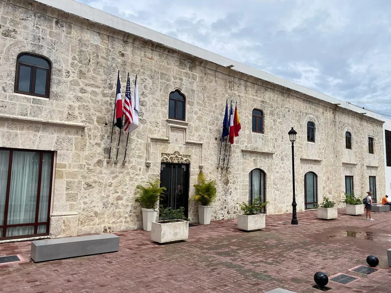
A few doors on stands the house associated with Ovando himself. The local guide says it was built about 1502 for the governor, and that it is also called the Casa de la Virreina and the Casa de los Cañones. It describes a mansion in a late Gothic style with carved stone windows, a mahogany ceiling and a courtyard facing the Ozama. It adds that Pedro Santana, the first constitutional president of the Dominican Republic, lived there for a short time, and that the building has been restored and is now a luxury hotel, the Hodelpa Nicolás de Ovando.
Take care with the details. The local guide places the residence on the eastern wall overlooking the river, and only a photo caption connects it to Calle Las Damas. The online encyclopedia says the house is now the Hostal de Ovando and mostly used by tourists, and describes it among the street's buildings. A local travel guide says the mansion was once split in two, for Ovando and for the Dávila family, and that the Casa de Ovando may have hosted Columbus, though that is uncertain. A hotel is a private business, so you see it from the street and go in only if you have a reason, but the facade and doorway are worth a look.
Casa de los Dávila and the Chapel
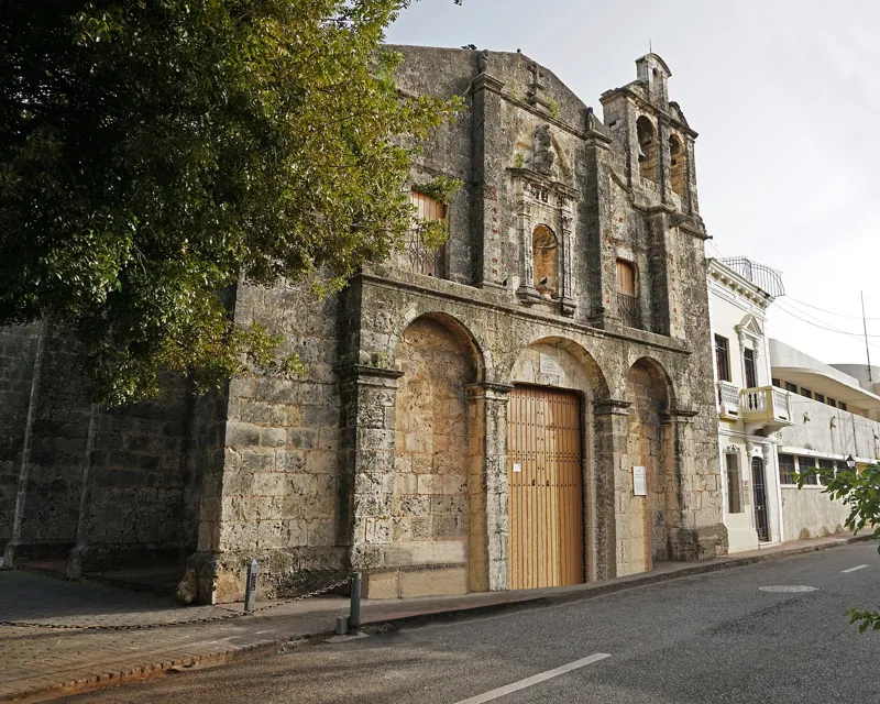
A local travel guide says the Casa de los Dávila dates from 1505 and was the residence of a city councilor and judge of the Real Audiencia, a member of a family that arrived with Ovando. It had a private chapel, the Capilla de los Remedios, and a small fort, the Fortín Invencible, and it is now part of the hostal. That matches the list in the Dominican tourism sources, which mention the Capilla de los Remedios near the plaza. The Dávila house rests on that one account. The story of the Audiencia itself is in the page on the Museo de las Casas Reales.
The Casa of Hernán Cortés
The online encyclopedia names one more house, saying that one of Ovando's residences was the home of Hernán Cortés, who later led the expedition that began the conquest of Mexico, and that it is now the French Embassy. The Cortés link has no second source, so treat it as a local tradition.
The Fortress at the Foot
At the south end the street meets the Fortaleza Ozama, the first major military structure on the island, according to the online encyclopedia, built in the early sixteenth century to defend the city against pirates and invaders from England, France and Portugal. The Ministry of Tourism lists the Museo de la Fortaleza among its Ciudad Colonial projects, which opened in March 2024, according to a report on the Alcázar's reopening. The full story of its construction, its use as a prison and its military life belongs to the page on the Fortaleza Ozama. For Calle Las Damas, what matters is the geography: the fort guards the river mouth and the street starts at its door.
The Panteón and the Casas Reales
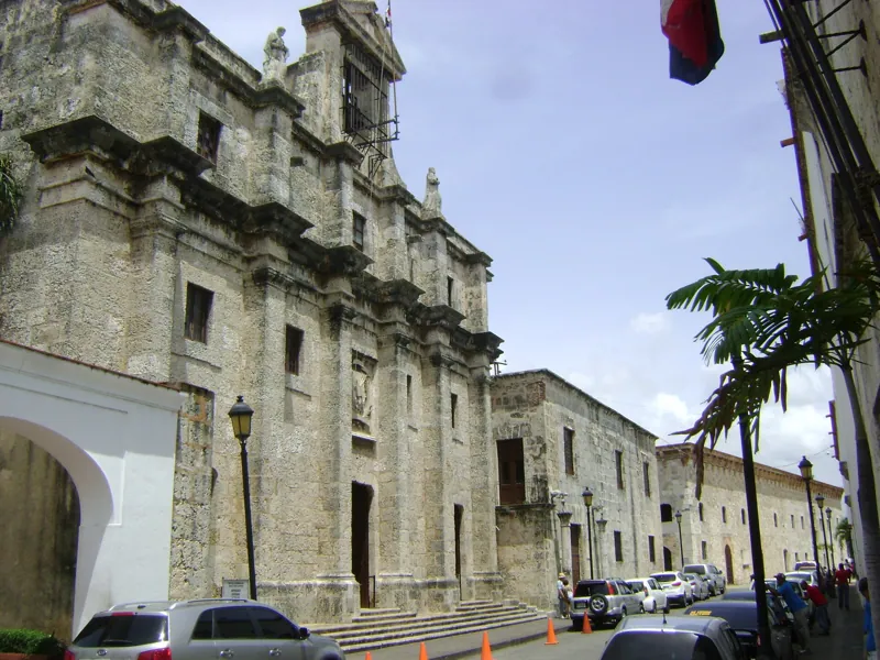
Halfway along stands the Panteón Nacional, a former Jesuit church that the online encyclopedia says was converted in 1958 into a resting place for national heroes. It has its own page at Panteón de la Patria, and the rules for visiting it are there.
A little farther, at the corner of Las Damas and Las Mercedes, are the Casas Reales, the governors' palace and the Real Audiencia, ordered in 1511 and now a museum. The online encyclopedia says the museum was restored and opened in 1976. The full account is on the page for the Museo de las Casas Reales. The building tells you something useful about the street, which is that its north half was the seat of government and its south half the seat of defense, with houses of officials in between.
The Sundial and the Plaza
Where the street ends, you meet the Reloj de Sol, the sundial dated 1753, and the plaza beyond it. The online encyclopedia places it in front of the Casas Reales at the end of Calle Las Damas and before Plaza España. The sundial is covered on the Casas Reales page. The plaza and the shipyards on its north side are the subject of Plaza de España and La Atarazana, and the Alcázar stands at the head of the street, as one tourism listing puts it, with the Fortaleza at its foot.
Other Buildings Worth a Look
A Dominican travel article names a few more attractions on the street, including the Museo del Cacao, and the Dominican Ministry of Tourism says many of the street's sixteenth-century buildings are now museums, embassies and upscale hotels. That sums up the current mix well. A walk down Calle Las Damas passes government, hospitality and culture in the same few hundred meters.
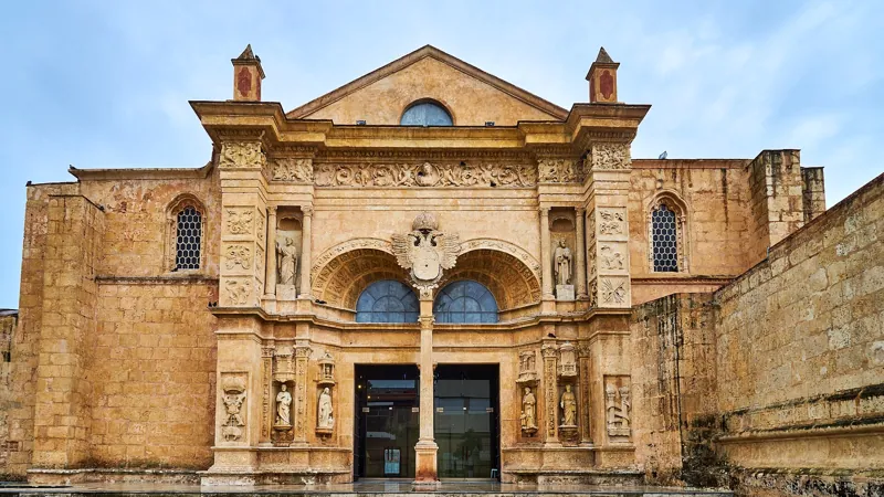
The street is also a good place to look at facades. The Casas Reales listing mentions Isabelline Gothic and Plateresque features, and the Casa de Ovando description mentions carved stone windows, so you know what to look for.
What the Street Shows About the Early Colony
Calle Las Damas is useful as a map of power. At one end is the fortress, which stood for defense and discipline. In the middle are the houses of governors and officials, among them a judge of the Real Audiencia and an early settler and explorer like Bastidas. At the other end are the court and the palace, where the Columbus family claimed a share of the New World and the Crown set up a court to check them.
It is also a street of people who did not stay. Ovando was recalled in 1509. Diego Colón went back to Spain in 1515 and died there in 1526. Bastidas died in Cuba. Cortés, if the tradition is right, left for Mexico. The houses outlasted the people, and each later owner or use left something in them: a hotel, a children's museum, an embassy. When a street has done five hundred years of work, the traces pile up.
For the story of the district as a whole, A History of the Zona Colonial sets the street in the arc from 1496 to the UNESCO listing of 1990. Diario Libre's 2026 report says the Ciudad Colonial was declared a World Heritage Site on 8 December 1990, which is the date it gives for the inscription.
Walking It Today
Start at the south end by the Fortaleza Ozama and walk north. The distance is well under a kilometer. Without stopping you could do it in ten minutes. With stops, give it an hour or two, or a whole morning if you go inside the museums.
A sensible order is the fortress first, then the Casa de Bastidas and the hotel house from the street, then the Panteón, then the Casas Reales and the sundial, and finally the Alcázar and the plaza. Go early. The street is narrow and the sun is high by late morning, and the early hours are the quietest.
What is open changes. The Alcázar reopened at the end of September 2026 after three years of work. The fortress museum opened in March 2024. The Casas Reales listings conflict on whether it is open, as the page on that museum explains, and the Ministry said in September 2026 that it had invested in it. The Casa de Bastidas museum may be under a different name. Check each before you go, and have a plan for the street itself, which is free and always open.
For routes that tie the street to the rest of the district, the landmarks guide, the Zona Colonial complete guide and the first city of the Americas history walk all use it as their spine.
Getting there from the penthouse
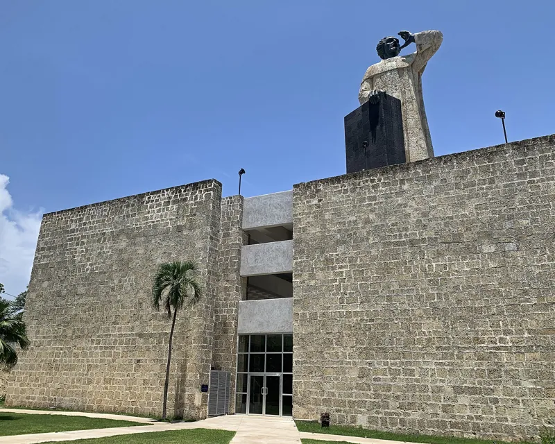
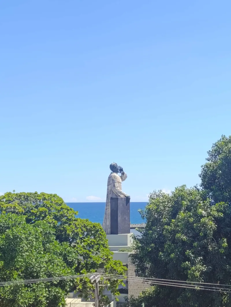
Penthouse Pallazzo is about 150 meters north of Playa Montesinos, facing the Montesinos monument, at roughly 18.4697, -69.8851. The south end of Calle Las Damas, near the Fortaleza Ozama, is northeast of the house. Using OpenStreetMap's coordinates for the street, the straight-line distance to its southern stretch is about 380 meters, which comes to about 10 minutes on foot. The north end at Plaza de España is farther, roughly 860 meters in a straight line, and about 15 minutes on foot.
So the street is the natural first stop of any walk from the house. Head toward the river, join Calle Las Damas near the fortress and follow it north. You walk its whole length on the way to the plaza, and you can turn back at any point.
Frequently asked questions
Is Calle Las Damas really the first paved street in the Americas?
The Dominican Ministry of Tourism and several travel guides say so. The sources that give construction details say only that it was laid out in 1502 on Ovando's order. The paving claim is widely repeated but is not tied to a document.
Why is it called the street of the ladies?
By tradition, the ladies of the court of María de Toledo, the wife of Diego Colón, strolled along it in the evenings. The name cannot be older than her arrival on the island in 1509, and it was earlier called Calle de la Fortaleza, according to the online encyclopedia.
What is on the street?
The Fortaleza Ozama at the south end, the Casa de Bastidas, the house of Ovando now a hotel, the Panteón Nacional, the Casas Reales and the sundial, and the Alcázar de Colón at the north end.
How long does it take to walk?
Under ten minutes without stopping, since it is well under a kilometer. With museum visits, plan a morning.
Can I go inside the old houses?
Some are museums, and some are private businesses such as a hotel. Check each, because opening status changes.
Sources
- https://www.godominicanrepublic.com/things-to-do/calle-las-damas
- https://www.ecured.cu/Calle_Las_Damas_(Santo_Domingo
- https://apuntesyviajes.com/2024/07/08/la-historia-de-la-calle-las-damas-en-santo-domingo/
- https://santodomingotour.com/landmarks/calle-las-damas
- https://www.colonialzone-dr.com/nicolas-ovando/
- https://vivedominicana.com/vive-santo-domingo-viaje-a-los-origenes-del-nuevo-mundo-desde-estas-15-casas-historicas-en-la-ciudad-primada-de-america/
- https://listindiario.com/la-vida/2016/05/15/419257/la-casa-de-rodrigo-de-bastidas.html
- https://eldia.com.do/la-dama-ausente-en-su-palacio-de-santo-domingo/
- https://www.diariolibre.com/actualidad/nacional/2026/09/28/abren-alcazar-de-colon-tras-renovacion-de-tres-anos/3672527
- https://www.ecured.cu/Reloj_de_Sol_(Rep%C3%BAblica_Dominicana
- https://www.ecured.cu/Museo_de_las_Casas_Reales_(Rep%C3%BAblica_Dominicana
- https://diariosocialrd.com/el-alcazar-de-colon-reabre-sus-puertas-con-una-nueva-mirada-a-la-historia-colonial/
- https://nominatim.openstreetmap.org/search?q=Calle+Las+Damas+Santo+Domingo&format=json&limit=3
- https://nominatim.openstreetmap.org/search?q=Alc%C3%A1zar+de+Col%C3%B3n+Santo+Domingo&format=json&limit=3