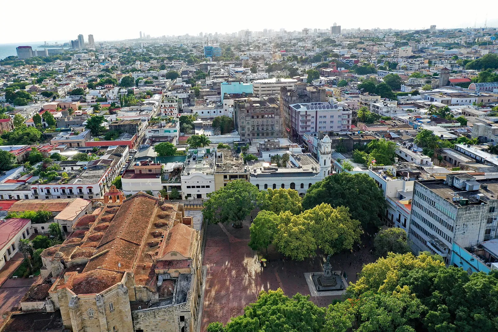
The Zona Colonial is small enough to cross on foot in a quarter of an hour, and its history is long enough that people argue about the year it began. The city was founded in the 1490s, moved in 1502, built many of its great stone buildings in the next fifty years, and then spent about three centuries on the edge of the Spanish empire while the world's attention went to Mexico and Peru. The old grid is still there, and it was inscribed as a UNESCO World Heritage Site in 1990.
This article follows that arc: the founding, the move, the peak, the long decline, the nineteenth century's upheavals, the twentieth century under a dictator, and the restoration since. It does not describe each building. Those have their own articles in the series, and each section below points to them. The history hub lists the full set.
Two Dates for a Founding
Nobody can say with certainty when Santo Domingo was founded. An Acento article states that no official document records the founding date, so several dates are debated. The one most often accepted is 1498, which comes from the thesis of the historians Apolinar Tejera and Fray Cipriano de Utrera. They hold that Bartholomew Columbus, Christopher's brother, founded the city that year on the east bank of the Ozama River, after receiving royal instructions in 1497. Other sources give 1496. Diario Libre says the first stone was laid on 4 August 1496, and another reference gives the same date. An Inmobiliario article notes that historians still disagree between 1496 and 1497.
The same Acento article untangles the celebration. The Church moved the commemoration to 4 August in 1558, and it is now observed on 8 August, while the city's national day is marked on 5 August. It also quotes the historian José G. Guerrero Sánchez, who says the city was never called "de Guzmán" until 1966. In its early years it was simply Nueva Isabela, named for Queen Isabel, and it later became Santo Domingo, after Saint Dominic.
What matters for a visitor is that the first settlement was not in the Zona Colonial. It stood on the east bank of the Ozama, across the river from the streets you walk today. The city you see was built on the other side a few years later.
The Hurricane and the Move of 1502
The city's first years were rough. The Library of Congress country study says Spain named the whole island Santo Domingo after the first settlement, and that Columbus, as royal governor, set up the repartimiento, a system that granted settlers land and the labor of the Indigenous people living on it. Francisco de Bobadilla replaced Columbus in 1499, and Ovando replaced Bobadilla in 1503. The study credits Ovando with starting the reforms that earned him the title Founder of Spain's Empire in the Indies. That is a generous title for a man whose governorship also included the Jaragua massacre, described in The Taíno of Hispaniola, and the encomienda that the Crown introduced in 1503.
The move has a precise cause, though the exact day is lost. Nicolás de Ovando arrived as governor on 15 April 1502 with about 30 ships and 2,500 people, according to Diario Libre. In early July of that year a hurricane sank a fleet carrying gold and rebel leaders, and the city was devastated. Ovando did not rebuild on the original site. He crossed the river and started again on the west bank, and the Acento article adds that the day and month of the move are unknown.
Inmobiliario describes the new city in a sentence worth remembering. It was laid out before it was inhabited, with right-angled streets, measured building plots and a central square as the political and religious heart. That is why the Zona Colonial feels like a plan and not like a village that grew. Next to the planned grid, the same article says, the neighborhood of Santa Bárbara grew without a plan, tied to the port and the river trade, and the contrast between the two is still visible.
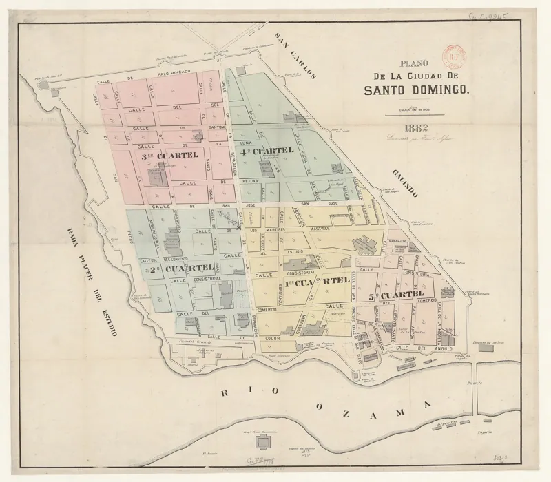
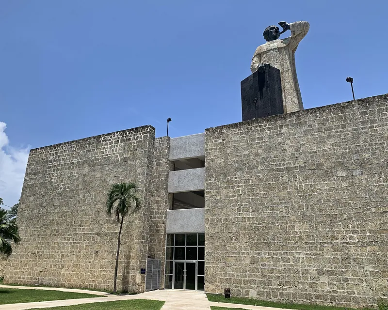
Ovando started with the buildings the colony could not do without. The fortress at the mouth of the river, the Fortaleza Ozama, was begun in 1502 according to Diario Libre, and the Dominican Foreign Ministry's visitor guide dates the main construction from 1502 to 1508. Its own story is in Fortaleza Ozama. The guide also dates the start of the Hospital San Nicolás de Bari to 29 November 1503, with the building reinforced in 1519 and finished in 1527. And it says the church of Nuestra Señora de la Altagracia was begun around 1503 to 1506, with building phases running to 1552, which makes it among the oldest religious buildings on the island.
The oldest houses are harder to date. The Casa del Cordón, which is now a Taíno museum, was erected in 1503 according to Diario Libre, and in 1507 according to Inmobiliario. Governor Ovando held office until 11 July 1509.
The Peak
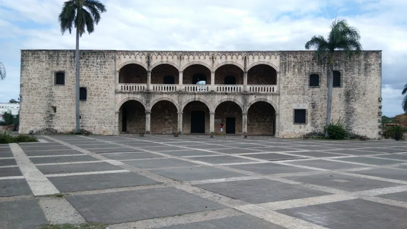
The Columbus family took over in 1509, when Ovando's successor Diego Colón, the Admiral's son, arrived. Diario Libre says he built the Alcázar de Colón, the palace that stands above Plaza de España and has its own article, Alcázar de Colón.
[[img: File:Casa_del_Cordon_CCSD_RD_11_2017_6568.jpg | The Casa del Cordón in the Colonial City of Santo Domingo | The Casa del Cordón, dated to 1503 or 1507 depending on the source]] Under him, in 1511, the Crown created the Audiencia, a tribunal meant to check the governor's power, according to the Library of Congress country study. The Dominican Foreign Ministry's guide says the building that housed it, the Casas Reales, was built on the order of King Ferdinand in 1511. In 1524 the Audiencia became the Royal Audiencia of Santo Domingo, and the same year Charles V created the Council of the Indies to run colonial affairs, the study says.
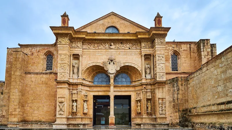
In a short time the city accumulated the buildings that make it unusual. Dominican friars founded a convent and a university, and the cathedral was begun, which Diario Libre dates to 1514. Its own article, Catedral Primada de América, covers the dates. The Franciscans built a monastery, with stonework dated by the Foreign Ministry's guide to between 1523 and 1664. The Santa Clara convent was built from 1550 to 1559. Even the sermon of Fray Antón de Montesinos belongs to this decade, and it has its own article, Fray Antón de Montesinos and His 1511 Sermon.
It is worth being plain about what paid for all this. The colony's first labor force was the Taíno, whose numbers collapsed within a few decades. The Library of Congress study says that from 1503 enslaved Africans were brought in, and that by about 1520 enslaved African labor was used almost exclusively. Sugar cultivation grew and increased the demand for labor. The story of the people who were here first is in The Taíno of Hispaniola.
The Slow Decline
The decline began quickly. The Library of Congress study says Cortés conquered Mexico in 1521 and that later gold and silver finds in Peru drew colonists away. One reference entry puts it more bluntly. After gold was found in Mexico and Peru, the city became a backwater of the Spanish empire, and hurricanes, invasions and civil wars limited its growth for about three centuries.
In 1586 the English corsair Francis Drake took the city and held it for about a month, and the damage was lasting. Diario Libre says he partly burned it, carried off bells, artillery and goods, and left the cathedral in use as a barracks, and the Library of Congress study says he collected a ransom for its return. The raid is told in full in Francis Drake's Raid on Santo Domingo in 1586.
The seventeenth century was harder. An Acento column by the historian Manuel Núñez Asencio describes the Osorio devastations of 1605 and 1606, when the Crown ordered the depopulation of the north and west of the island to stop smuggling. It says they destroyed 120 cattle ranches and more than 100,000 head of cattle, of which only about 15 percent were saved, and mills and farms were lost too. It lists the figures that followed. In 1606 it counts 1,117 white householders in ten settlements, with the capital given 648 inhabitants, and more than 10,000 enslaved people. By 1650 the householder count was 1,021. Smallpox killed more than 3,000 people in 1666 and 1669, earthquakes struck in 1671 and 1673, and hurricanes in 1668 and 1672. The 1681 census counted 6,312 people in the colony, of whom 2,434 were Spanish, 2,195 enslaved and 1,640 free people of mixed ancestry. The colony survived on a royal subsidy, the situado, which came first from Panama and later from New Spain.
Politics took more. An English fleet under Sir William Penn failed to take Santo Domingo in 1655 and seized Jamaica instead, according to the Library of Congress study. French buccaneers settled the abandoned western half of the island, and the Treaty of Ryswick in 1697 gave the western third to France. The study calls the French colony, Saint-Domingue, the most productive agricultural colony in the Western Hemisphere, and says Santo Domingo's landowners never reached the wealth of their French counterparts.
A Century of Change
The Bourbons replaced the Habsburgs in Spain in 1700, and their trade reforms began to revive the colony, the Library of Congress study says. How the city lived through the 1700s, including the 1760s, when the townhouse that holds the penthouse was built, is in Santo Domingo in the 1700s.
The years after 1795 were more turbulent than anything since Drake. Spain ceded its part of the island to France that year under the Treaty of Basel, though French rule on the ground began only in the early 1800s, and an El Día article describes a French period that lasted until 1809, with Haitian forces under Dessalines and Christophe besieging the capital for nearly three months in early 1805. In 1808 Dominican forces led by Juan Sánchez Ramírez defeated the French at Palo Hincado, besieged the capital for just over eight months, and in July 1809 the French surrendered the city to the British, who handed it back, and the Spanish flag went up again. After independence the capital stayed the seat of government, and the early years were rarely calm. The Library of Congress study says Pedro Santana's forces took Santo Domingo on 12 July 1844, and that Dominican forces repelled Haitian land and sea attacks in December 1845 and again in April 1849, and defeated a larger Haitian invasion between November 1855 and January 1856. Between those events the country had a new constitution, a string of presidents, and a devaluation crisis that set off the Revolution of 1857. Very little of this produced new building in the old city. Much of what you see inside the walls was already standing.
On 30 November 1821 the lieutenant governor, José Núñez de Cáceres, proclaimed independence as "Spanish Haiti," according to the Library of Congress study. The Haitian president, Jean-Pierre Boyer, invaded before that was resolved, and the occupation that followed lasted twenty-two years. The Dominican Republic's independence in 1844 is the subject of Puerta del Conde and Independence in 1844.
The Twentieth Century
By 1908 the city had about 19,000 inhabitants. On 3 September 1930 the San Zenón hurricane hit it. An EFE report published by El Día says the storm killed about 2,000 people, and that most buildings outside the walled colonial center were fragile wooden structures, which suffered most. The stone buildings inside the colonial walls withstood the winds better. The historian Roberto Cassá told EFE that the colonial city "no fue destruida," was not destroyed, and called the claim that Trujillo had rebuilt it false.
Outside the walls, the city was growing fast. Under Trujillo, who ruled from 1930 to 1961, the capital received large neoclassical public buildings including the Presidential Palace and the Palace of Fine Arts, that a national university was established in 1966, and that by 2007 about 2.25 million people lived in the city's roughly 60 square miles, almost a quarter of the national population. Set against that, the colonial grid is a very small part of the city, and that is part of what makes it feel like a neighborhood and not a district of monuments.
Rafael Trujillo's government renamed the capital. In 1936 Parliament approved the name Ciudad Trujillo, which stayed until after his assassination in 1961. Cassá calls the hurricane the pretext for the renaming, in the El Día report. Trujillo's rule also left marks on the old city. Diario Libre says he added a crenellated wall to the Fortaleza Ozama in 1937, and that it served as a prison until 1970. The Foreign Ministry's guide says the former Jesuit church on Calle Las Damas became a mausoleum for national heroes from 1956. It has its own article in the series, on the Panteón de la Patria.
The turn toward protection began later. An Acento opinion piece says the work started in 1967, when President Joaquín Balaguer created the Oficina de Patrimonio Cultural to restore and preserve the Colonial City, and that a presidential decree the same year gave the Ministry of Tourism management of the Alcázar de Colón. The columnist's argument is that tourism then gradually took priority over culture. That is the columnist's view, and it is fair to read it as one.
UNESCO inscribed the Colonial City of Santo Domingo as a World Heritage Site in 1990. The Dominican Foreign Ministry's guide gives the date as 8 December 1990, and UNESCO's listing is number 526 on its World Heritage list.
Since 1990
Money and attention followed. The same Acento column lists two loans from the Inter-American Development Bank, US$30 million starting in 2011 and US$90 million signed in 2016, both with a strong focus on tourism and both managed by the Ministry of Tourism. The column describes the current program as having four components, a cultural tourism offer, habitability, local economies and tourism, cultural and urban management, and says it plans to remodel 140 residents' homes. It also names the architects who pushed for a heritage approach over the years, among them Ramón Báez López-Penha, Iván Feris Iglesias, Roberto Berges, Eugenio Pérez Montás and Esteban Prieto.
Not everything is smooth. The Inmobiliario article reports that shopkeepers complain that renovations drag on and force them to close, and that residents and experts are asking why streets that never flooded now do, and whether the old drainage system is being lost. Its argument, which is hard to dispute from a walk through the neighborhood, is that the colonial city's value is that it works as a living neighborhood and not only as a set of monuments.
The most recent change is in what the old buildings are used for. The Casa del Cordón opened as the Centro Cultural Taíno in November 2024. The same Inmobiliario article describes three layers of the capital that still coexist: the colonial grid, the modern city of the Malecón, Gazcue, Naco and Piantini, and the city of migration that grew up the ravines and river margins. The Zona Colonial is the first of the three, and the smallest.
The Dates to Remember
If you want the whole arc in a short list, these are the dates this article rests on, with the caveat that the founding year is disputed.
- 1496 or 1498. Bartholomew Columbus founds the first settlement on the east bank of the Ozama.
- 1502. After a hurricane, Ovando moves the city to the west bank and lays out the grid.
- 1511. The Audiencia is created, and Montesinos preaches his Advent sermon.
- 1521. Cortés conquers Mexico, and the colony begins to lose its people and its importance.
- 1586. Drake takes the city and holds it for about a month.
- 1605 and 1606. The Osorio devastations empty the north and west of the island.
- 1697. The Treaty of Ryswick gives the western third of the island to France.
- 1795. The Treaty of Basel cedes the Spanish part of the island to France.
- 1844. The Dominican Republic becomes independent.
- 1930. The San Zenón hurricane hits, and the stone city inside the walls withstands it better than the wooden city outside.
- 1936. The capital is renamed Ciudad Trujillo, and the name is dropped after 1961.
- 1967. President Balaguer creates the Oficina de Patrimonio Cultural to restore the Colonial City.
- 1990. UNESCO inscribes the Colonial City of Santo Domingo as a World Heritage Site.
Reading the Arc on Foot
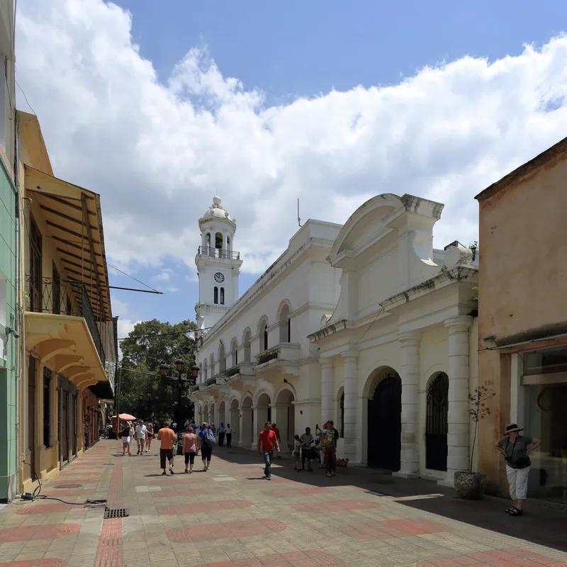
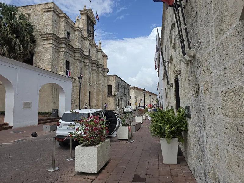
You can see most of this on a single walk. The grid itself is the 1502 plan, and it is easiest to feel on Calle Las Damas and the streets that cross it. The Fortaleza is Ovando's, with Trujillo's wall added. The Hospital San Nicolás, Altagracia church and Casa del Cordón are among the oldest stones in the city. The Alcázar and the Casas Reales belong to the peak. The ruins of the Monasterio de San Francisco and the hospital tell the story of the decline, since the Foreign Ministry's guide says both were damaged in 1586, and the Panteón belongs to the eighteenth century and then to the twentieth. The clock tower of the Palacio Consistorial on Parque Colón looks colonial but is not. Inmobiliario says the building's present look dates mainly from 1906 to 1913, with the public clock installed on 9 October 1915.
For a route that links these, the site's landmarks guide and the Zona Colonial complete guide lay out the walk and the practical details.
Getting there from the penthouse
The old center around Parque Colón is at roughly 18.4734, -69.8840, and Penthouse Pallazzo sits at roughly 18.4697, -69.8851. The straight-line distance is about 430 meters. Multiplied by 1.3 and divided by 80 meters a minute, the walk is about 10 minutes on foot. From the park, the Fortaleza Ozama is in one direction and Calle Las Damas and the Alcázar in the other. The location page shows the house on a map.
Frequently asked questions
When was Santo Domingo founded?
Sources disagree. The date most often accepted is 1498, from the thesis of the historians Apolinar Tejera and Fray Cipriano de Utrera, but Diario Libre and another reference give 4 August 1496. An Acento article says no official document records the date. The first settlement was on the east bank of the Ozama River.
Why was the city moved to the west bank?
A hurricane in July 1502 devastated the first settlement, soon after Governor Nicolás de Ovando arrived with about 30 ships. Ovando built a new city on the west bank, laid out with right-angled streets and a central square before anyone lived there.
Why is it called the Zona Colonial?
It is the part of the city that was built in the colonial period and kept its grid and its old buildings. Dominicans also call it the Ciudad Colonial. UNESCO lists it as the Colonial City of Santo Domingo, inscribed in 1990.
Did the 1930 hurricane destroy it?
No. An EFE report in El Día says the stone buildings inside the colonial walls withstood the winds better than the wooden buildings outside them, and the historian Roberto Cassá says the colonial city was not destroyed. The hurricane struck on 3 September 1930 and killed about 2,000 people according to that report.
Was the city ever renamed?
Yes. From 1936 until after the assassination of Rafael Trujillo in 1961 it was called Ciudad Trujillo.
Sources
- https://acento.com.do/cultura/no-existe-un-documento-oficial-sobre-el-dia-de-la-fundacion-de-santo-domingo-de-guzman-9232530.html
- https://acento.com.do/actualidad/cuando-se-fundo-santo-domingo-el-origen-de-la-primera-ciudad-de-america-que-nacio-un-5-de-agosto-9731111.html
- https://www.diariolibre.com/portada/reportaje/la-ciudad-de-santo-domingo-y-sus-invaluables-tesoros-coloniales-BP27939181
- https://inmobiliario.do/en/530-years-later-santo-domingo-still-has-three-urban-layers/
- https://inmobiliario.do/el-simbolo-mas-famoso-de-la-ciudad-colonial-no-es-colonial/
- https://encyclopedia.com/humanities/encyclopedias-almanacs-transcripts-and-maps/santo-domingo
- https://countrystudies.us/dominican-republic/3.htm
- https://countrystudies.us/dominican-republic/4.htm
- https://countrystudies.us/dominican-republic/5.htm
- https://acento.com.do/opinion/el-siglo-xvii-siglo-de-la-miseria-y-de-la-pobreza-9605605.html
- https://eldia.com.do/la-era-de-francia-en-santo-domingo-1803-1809-1-de-2/
- https://eldia.com.do/el-fin-de-la-era-de-francia-y-la-reconquista-de-santo-domingo-parte-2/
- https://eldia.com.do/san-zenon-el-huracan-que-arraso-santo-domingo-y-le-dio-nombre-de-dictador/
- https://acento.com.do/opinion/la-modernizacion-de-la-ciudad-colonial-9764391.html
- https://mirex.gob.do/wp-content/uploads/2024/01/Un-Paseo-por-la-Ciudad-Colonial.pdf
- https://www.diariolibre.com/revista/cultura/2024/11/19/inauguran-centro-cultural-taino-casa-del-cordon/2916503
- https://commons.wikimedia.org/wiki/File:Aerial_view_Ciudad_Colonial_Santo_Domingo_09_2019_0067.jpg
- https://commons.wikimedia.org/wiki/File:Casa_del_Cordon_CCSD_RD_11_2017_6568.jpg
- https://commons.wikimedia.org/wiki/File:Calle_las_Damas,_Santo_Domingo,_Zona_Colonial.jpg
- https://nominatim.openstreetmap.org/search?q=Parque+Colón+Santo+Domingo&format=json&limit=3